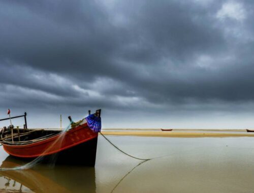
MOUSUNI ISLAND
Location: Reach Namkhana by bus or train.Cross the Hatania Doania river by boat (10minutes ride).Take Magic van (every 15mins service) or book a TOTO and reach Bagdanga kheya ghat (30mins ride).Cross the river and reach Bagdanga by boat (20 mins…
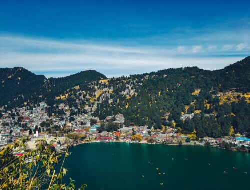
NAINITAL-KAUSHANI-MUNSIYARI-PATAL BHUBANESWAR-ALMORA
Introduction: Kumaon or Kumaun is one of the two regions and administrative divisions of Uttarakhand, a mountainous state of northern India, the other being Garhwal. It includes the districts of Almora, Bageshwar, Champawat, Nainital, Pithoragarh, and Udham Singh Nagar. It is bounded on the north by Tibet, on the east by Nepal, on the south by…
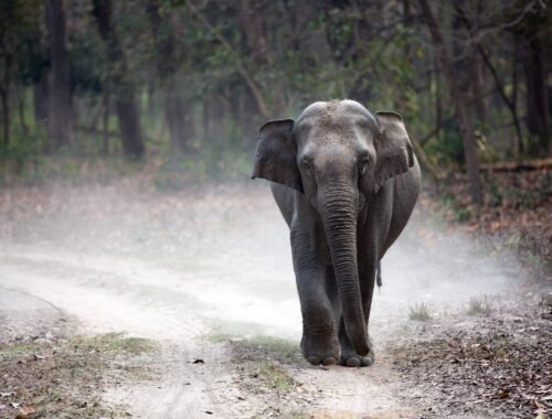
NAINITAL – JIM CORBETT PARK
Introduction: Kumaon or Kumaun is one of the two regions and administrative divisions of Uttarakhand, a mountainous state of northern India, the other being Garhwal. It includes the districts of Almora,Bageshwar,Champawat, Nainital, Pithoragarh, and Udham Singh Nagar. It is bounded on the north by Tibet, on the east by Nepal, on the south…
HARIDWAR-AULI-JOSHIMOTH
Introduction: Haridwar local pronunciation , also spelled Hardwar, is an ancient city and municipality in the Haridwar district of Uttarakhand, India. According to popular Hindu legend, it was here that Goddess Ganga when Lord Shiva released the mighty river from the locks of his hair. The River…
HARIDWAR & MUSSOORIE
Introduction: Haridwar pronunciation also spelled Hardwar is an ancient city and municipality in the Haridwar districtof Uttarakhand, India. The River Ganga, after flowing for 253 kilometres (157 mi) from its source at Gaumukh at the edge of the Gangotri Glacier, enters the Indo-Gangetic Plains of North India for the first time at Haridwar, which gave…
DERHADUN-AULI-JOSHIMOTH
Introduction: Dehradun also spelled Dehra Dun, is the interim capital of Uttarakhand, a state in India. Located in the Garhwal region, it lies 236 kilometres (147 mi) north of India’s capital New Delhi and 168 kilometres (104 mi) from Chandigarh. It is one of the “Counter Magnets” of the National Capital Region (NCR) being developed as…
TRIPURA
Introduction: Tripura is a state in Northeast India. The third-smallest state in the country, it covers 10,491 km2 (4,051 sq mi) and is bordered by Bangladesh to the north, south, and west, and the Indian states of Assam and Mizoram to the east. In 2011 the state had 3,671,032 residents, constituting 0.3% of the country’s…
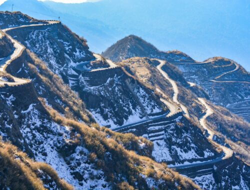
SILK ROUTE
Introduction: Sikkim Silk Route tour is one of the most famous attractions in East Sikkim. Zuluk (also spelled as Dzuluk) was once an important stop on the Ancient Silk Road. Today Sikkim Silk Route is known for its clear and…
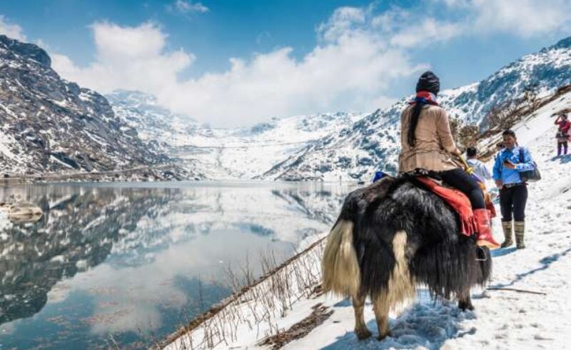
KALUK-PELLING-NAMCHI-RAVANGLA
Introduction: Sikkim is a state in northeastern India. It borders Tibet in the north and northeast, Bhutan in the east, Nepal in the west, and West Bengal in the south. Sikkim is also located close to India’s Siliguri Corridor near Bangladesh. Sikkim is the least populous and second smallest among the Indian states. A part of the Eastern Himalaya, Sikkim…
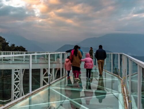
GANGTOK
Introduction: Sikkim is a state in northeastern India. It borders Tibet in the north and northeast,Bhutan in the east, Nepal in the west, and West Bengal in the south. Sikkim is also located close to India’s Siliguri Corridor near Bangladesh. Sikkim is the least populous and second smallest among the Indian states. A part of the Eastern Himalaya, Sikkim…